
For the latest on COVID-19 (Coronavirus) click here
Josh Miller/Getty Images
Pacific Crest Trail: Carson Pass

Pacific Crest Trail: Carson Pass
Explore the Mokelumne Wilderness south of Lake Tahoe on a day hike or backpacking trip
Day hike: 8.8 miles round-trip to Round Top Lake and Round Top Peak
Backpack: 11 miles round-trip to Fourth of July Lake
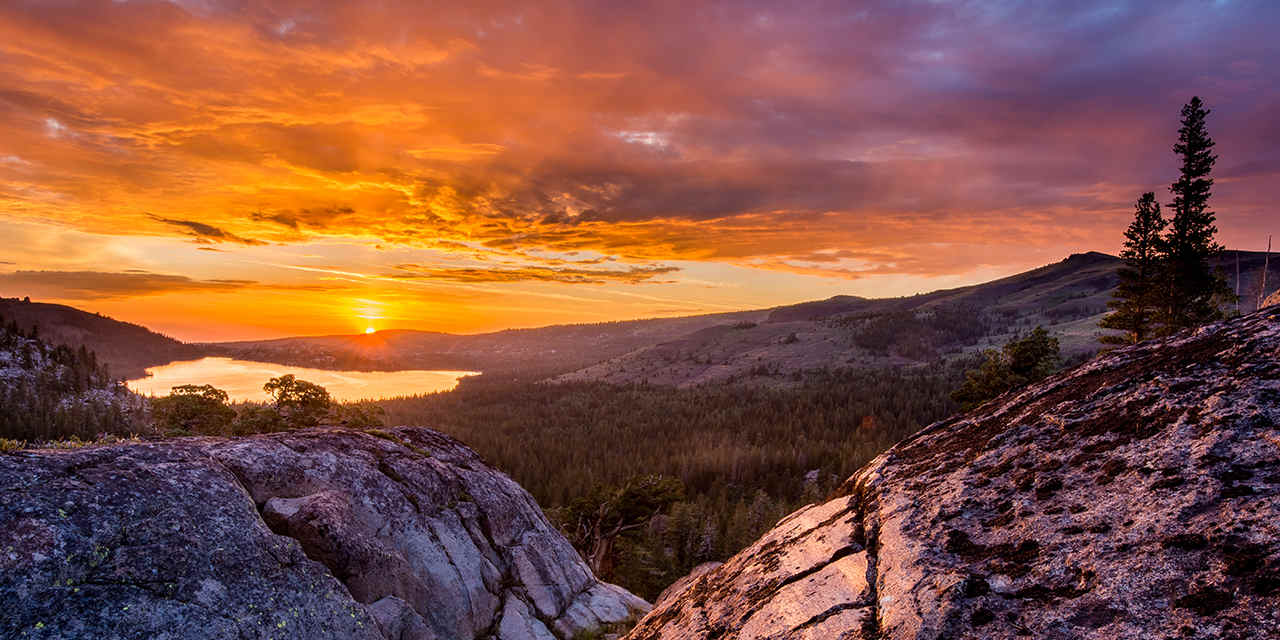
Just 30 miles south of Lake Tahoe, Highway 88’s Carson Pass region combines some of the Sierra’s loveliest scenery with some of its most flower-filled hiking trails. The PCT crosses the highway at 8,600-foot Carson Pass, heading north toward Tahoe and south toward Yosemite. Take the PCT south to explore the Mokelumne Wilderness—possible journeys include a day hike to Round Top Lake, a summit ascent of Round Top Peak, or a quickie overnight backpacking trip to Fourth of July Lake.
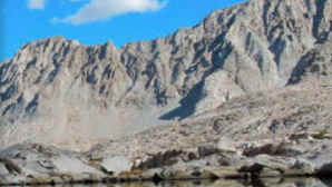
Start at the Carson Pass Information Station on Highway 88 (be sure to pay the $5 parking fee and pick up a wilderness permit). After an initial climb of about a half mile, you’ll see the trees thin out and alpine wildflowers start to appear. These volcanic soils nourish an incredible variety of flowers—visit in July and you’ll see fields of lupine, paintbrush, mule’s ears, and more. Pass Frog Lake on the left, then press onward to reach photogenic Winnemucca Lake, a blue-green gem whose shoreline is dotted with clusters of whitebark pines and hemlocks. Take a snack break, then continue steeply uphill for another mile to Round Top Lake, set directly below 10,381-foot Round Top Peak. The lake’s deeply carved glacial cirque is postcard-perfect, and a few stands of trees provide shade for picnickers.
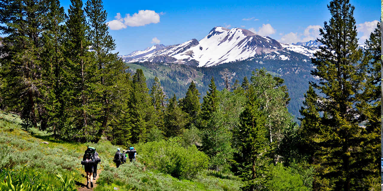
This is a fine place to call it a day, but ambitious, sure-footed hikers can opt for a summit ascent by following the footpath from the lake’s east end. The route struggles up, up, and up Mount Round Top’s volcanic slopes. The last 50 yards to the summit requires a third-class scramble, so go only as high as your comfort level allows. Whether you make it to the tippy-top or not, its knife-thin ridge offers dazzling vistas. Survey the view of Lake Tahoe, Caples Lake, Woods Lake, Round Top Lake, Winnemucca Lake, and Frog Lake—all to the north. Even more dramatic is the southward vista of deep and immense Summit City Canyon, 3,000 feet below. On the clearest days, Mount Diablo in the San Francisco Bay Area, 100 miles to the west, can be seen.
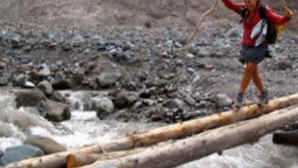
Backpackers continuing to Fourth of July Lake should take the left fork near Round Top Lake and head west, curving around the volcanic peaks known as The Sisters. Just over half a mile along the trail you’ll reach rocky Fourth of July Saddle, where you can look straight down 1,000 feet to the lake. Make your way down the switchbacks to the water’s edge, where there are several good campsites and decent fishing for brook and cutthroat trout. Late in summer, as the lake level drops, a sandy beach is exposed—a perfect spot for a well-earned swim.


Danita Delimont/Alamy
Spotlight: Pacific Crest Trail
More Ideas
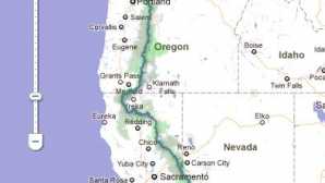
The Pacific Crest Trail extends for a whopping 2,650 miles from Mexico to Canada, forging an unbroken footpath through three states—California, Oregon, and Washington. It crosses over deserts and tunnels through forests, travels across glaciated mountain passes, and skirts the shoulders of conical volcanic peaks. To hike the entire trail takes about five months—if all goes well—walking an average of 16 to 18 miles per day. Many hikers plan on six months to account for the vagaries of mountain weather and the need for rest and resupply days.
The tri-state trail was the dream of Harvard graduate Clinton Churchill Clarke, who had been a Boy Scout as a child. In the 1930s, he and his friend Warren Lee Rogers created the Pacific Crest Trail (PCT) System Conference, which united several hiking clubs and youth groups. The men began lobbying to link together existing trails to create a border-to-border trail. Members of the Young Men’s Christian Association and the Boy Scouts organization supported their efforts by scouting the trail’s planned route. Even world-famous photographer Ansel Adams played a role on the PCT conference’s executive committee.
Progress was slow. In 1968, President Lyndon Johnson finally signed the National Trail Systems Act, which named the East Coast’s Appalachian Trail and the Pacific Crest Trail as the first two national scenic trails. Over the next 25 years, countless individuals built nearly 1,000 miles of the PCT. It was completed in 1993.
The PCT was mostly known only to serious hiking enthusiasts until 2012, when Cheryl Strayed’s memoir Wild, detailing her 1,100-mile solo journey on the trail, was published. Her book was later made into a film of the same name starring Reese Witherspoon, and the accompanying notoriety led to a spike in the number of people attempting all or part of the trail.
Typically, a few hundred people each year hike the entire PCT, but thousands more hike some portion of it. Whether you choose to day hike or take a short backpacking trip, here are six major Pacific Crest Trail access points—from San Diego County up to the Shasta Cascade region—where you can go have your own Wild California experience, listed south to north.
– Ann Marie Brown
More Ideas

Discover San Diego County
Perfect weather, challenging course, and incredible settings make San Diego County a golfer’s dream destination. It’s not surprising that many of the world’s leading golf...

Discover the Central Coast
Sierra Mar at Post Ranch Inn gives you the feeling of dining at the very edge of the continent. Looking westward from the dramatic, contemporary building, cantilevered...

Discover Shasta Cascade
Established by local farmers, the Tehama Trail meanders through rural communities, linking together nearly two dozen vineyards, orchards, and grass-fed beef ranchers and...